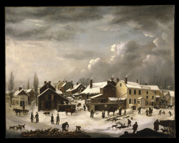
Winter image is some village in Brooklyn by Francis Guy, c. 1819.
On its own, Brooklyn is perhaps the 3rd largest city in the US. However, it was incorporated into New York City in 1898 after much political squabbling.
It's basically a 70 square-mile peninsula of the western end of Long Island, jutting into New York harbor. Named after Breukelin in Holland as it was first settled by the Dutch (if you don't consider the Lenape Indians who were there then).
It is a boom town now with high-rise office buildings and luxury buildings sprouting up everywhere. Gentrifying rapidly. Still, much of it is a brownstone townhouse and wood-frame house city of developments built on farmland from the mid-1800s through the 1920s. Like much of the New York metropolitan area, it has an abundance of relatively distinct neighborhoods distinguished by class, ethnicity, affinity groups, etc. There are Hasidic and Orthodox areas, black areas, Italian neighborhoods, hipster neighborhoods, blue-collar neighborhoods, fully-mixed neighborhoods, quite down-at-the- heels areas like East New York, industrial and warehouse areas, upper class neighborhoods - almost everything but Asian neighborhoods which are mostly in Queens. And yes, Coney Island too.
While it is a city unto itself, there is no doubt that the economic engine for it is Manhattan even though many Brooklynites rarely venture into Manhattan. And vice-versa, except for the BAM and Peter Lugar's Steakhouse.
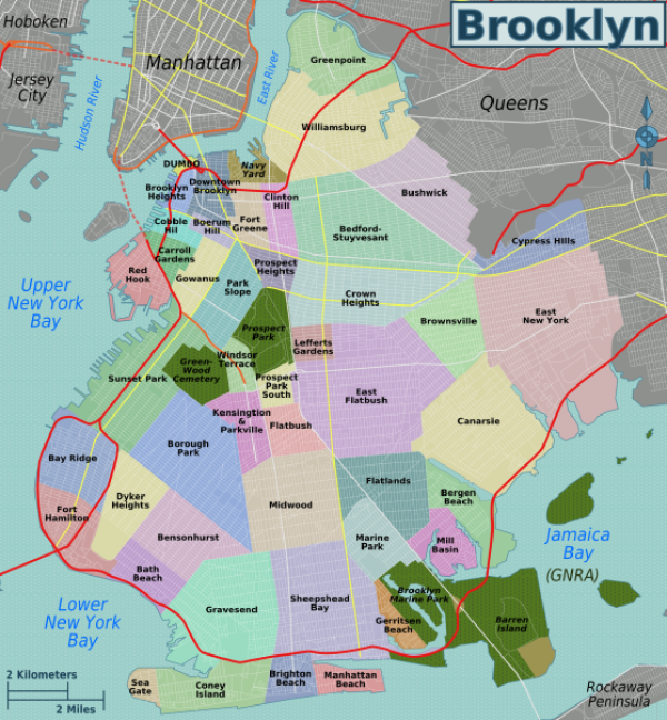
There's a good map of the Brooklyn neighborhoods below the fold. Our 12-mile hike last Sat. did not get much further than the westernmost neighborhoods. It would take a lot of time to explore the whole place on foot. I have a daughter in Crown Heights and a nephew in Williamsburg. One of our hiking pals was born in Brooklyn Heights. My grandma (from Norwalk, CT) taught school in Clinton Hill before she got married to a prosperous physician from Connecticut.
Will post my photos when I get around to it.


